Drill Results
Black Mammoth identifies anomalies at Callaghan
BMM · Price
Executive Summary
- Black Mammoth Metals Corp. released results from a pole-dipole induced polarization (IP) geophysical survey at its Cottonwood target on the Callaghan property in Nevada, identifying significant chargeability anomalies and defining new drill targets.
- The company staked 152 new unpatented lode claims, expanding the Callaghan property to a total of approximately 1,785 hectares (4,411 acres).
- The IP survey was conducted to assess intense sulphide gold mineralization previously encountered in the 2025 spring drilling campaign, which identified a large, intrusive-related gold system.
Key Details
- Geophysical Survey Results:
- Conducted nine (9) IP lines with a total length of approximately 23,800 line kilometres.
- Identified a high-chargeability anomaly in the western-southwestern portion, possibly related to high-sulphide content, with an east-west maximum width of ~750 metres at 100- to 200-metre depth.
- Identified a potentially higher-grade, gold-mineralized structural corridor between a magnetic anomaly to the east of recent CW drill holes and chargeability anomalies to the west.
- Identified a chargeability anomaly in a possible upper contact zone with Paleozoic basement rocks at the southern end of the interpreted intrusion, with an east-west maximum width of ~750 m at 300- to 500-metre depth.
- The survey suggests a prospective corridor with three potential targets measuring 3.5 km in length by 1.3 km in width.
- Drilling Context (2025 Spring Campaign):
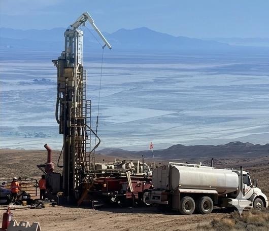
- The IP survey assessed results from three reverse circulation holes (CW-1, CW-2, and CW-2B) that intersected strongly altered rocks with associated gold anomalies.
- Hole CW-2B returned the best gold intercept: 61 metres of 0.416 g/t Au, including 3.048 m of 3.57 g/t Au.
- Alteration observed includes silicification and marbleized carbonates with abundant disseminated pyrite, suggesting a large, intrusive-related gold system.
- Land Acquisition:
- Staked 152 unpatented lode claims managed by the Bureau of Land Management.
- Combined with 62 existing claims, the Callaghan property now covers approximately 1,785 hectares (4,411 acres).
- The company holds a 100% interest in the Callaghan property.
- Future Plans:
- Drill testing is required to prove mineralization in the identified target zones.
- The existing notice of intent will need to be amended for further drilling.
- Target zones have good dirt road access requiring minimal property surface disturbance.
Notable Quotes
- No direct quotes from management were included in the provided text.
More from Black Mammoth Metals Corporation
Jul 13, 2026 · 09:00