Technical Study
Grande Portage Resources Advances Ongoing Project Studies and Fieldwork to Support New Amalga Gold Project Development
GPG · Price
Executive Summary
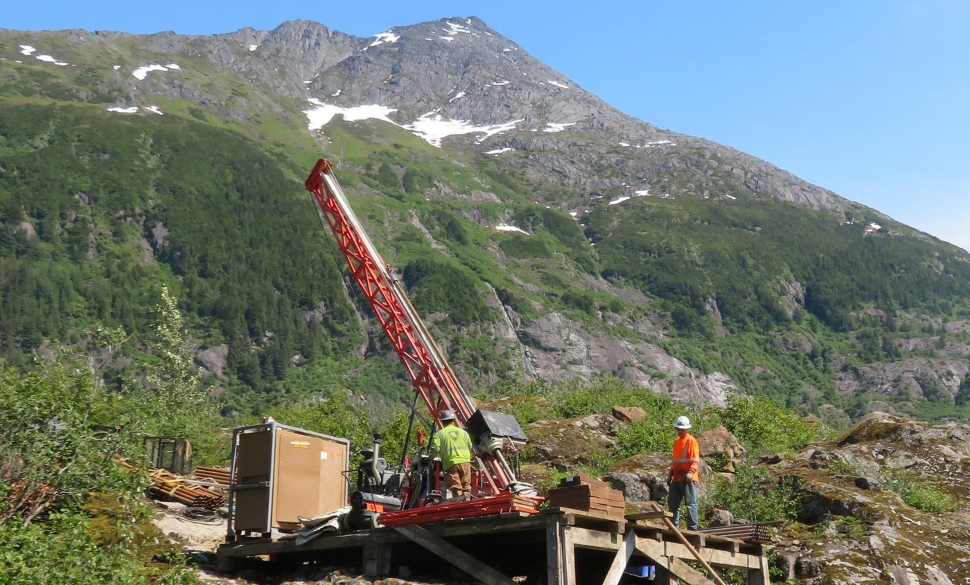
- Grande Portage Resources provided a comprehensive project update for the New Amalga Gold property, detailing an extensive roster of engineering and environmental fieldwork programs designed to support the upcoming State and Federal Environmental Impact Statement (EIS) and permitting process.
- The company highlighted updated Preliminary Economic Assessment (PEA) economics effective February 11, 2026, showcasing a small-footprint underground mining strategy with offsite third-party processing, yielding strong base-case and upside NPV/IRR figures.
- Additional material updates include the signing of an LOI with Goldbelt Inc. for an ore export terminal, reaffirmation of the July 2024 Mineral Resource Estimate, and disclosure of select high-grade historical drill intercepts.
Key Details
- 2026 Environmental & Engineering Fieldwork Programs: Numerous studies initiated with industry-leading consultants to feed into the NEPA environmental review and regulatory permitting:
- Access Road Design (RESPEC): Engineering design and geotechnical surveys; applying for State of Alaska easement to establish a closer drilling materials staging area and helipad.
- Aquatic Studies (Alaska Dept of Fish & Game): Field surveys and sampling to inform ADF&G Fish Habitat Permits and mine design protective of fish habitat.
- Climate Assessment (Stantec): Evaluation of current/future climate conditions to define engineering criteria for snowfall, precipitation, and environmental controls.
- Archeological & Cultural Surveys (Stephen R. Braund & Associates): Field surveys to comply with Alaska Historic Preservation Act and Section 106 of NHPA.
- Avian & Wildlife Surveys (Stantec): Aerial, foot, and sensor surveys for eagles, goshawks, marbled murrelets, and terrestrial wildlife.
- Geochemical Characterization & Backfill Testing (Stantec): Testwork on core samples for acid generation/metals leaching potential and strength of proposed cemented rock fill backfill.
- Geohazard Surveys (Stantec): Risk zone identification for avalanches, landslides, floods, and seismic events.
- Meteorological Station Construction (Boreal Services): Installation of two stations for temperature, precipitation, wind, solar, humidity, and dust data; US Forest Service Special Use Permit secured.
- Recreation Assessment (McKinley Research Group): Baseline public recreation use mapping to inform NEPA review.
- River Flow Instrumentation (Brailey Hydrologic): Gauging installation on Herbert River for APDES permit design; preliminary installation completed May 2026.
- Sensitive, Rare & Invasive Plant Surveys (Stantec): Identifying species requiring protective mitigations per US Forest Service plans.
- Traditional & Subsistence Research (Stephen R. Braund & Associates): Literature review and tribal consultation for cultural resources and subsistence uses.
- Surface Water Sampling (Nortech Engineering): Multi-year baseline water quality analysis for APDES permitting.
- Traffic Surveys & Highway Studies (RESPEC): Vehicle-count and bridge/road condition modeling for Glacier Highway trucking routes.
- Wetlands & Soils Delineation (Stantec): Phase Two mapping of jurisdictional waters to inform mine layout and Clean Water Act Section 404 permitting.
- Preliminary Economic Assessment (PEA) Economics (Effective Feb 11, 2026): Development concept utilizes a small-footprint underground mine with offsite third-party processing, eliminating the need for an onsite mill, tailings facility, or permanent waste rock storage. Base case ($3,200/oz Au): After-tax NPV5 of US$721m, IRR of 56%. Upside case ($5,000/oz Au): After-tax NPV5 of US$1,557m, IRR of 91%.
- Strategic Agreement (LOI): Signed a Letter of Intent with Goldbelt Inc. (an Alaska Native Corporation) for the development of an ore export terminal at Cascade Point, located 22km from the project site.
- Mineral Resource Estimate (Effective July 17, 2024):
- Indicated: 1,438,500 oz Au @ 9.47 g/t Au (4.726 Mt) & 891,600 oz Ag @ 5.86 g/t Ag (4.726 Mt).
- Inferred: 515,700 oz Au @ 8.85 g/t Au (1.813 Mt) & 390,600 oz Ag @ 7.33 g/t Ag (1.813 Mt).
- Deposit remains open to north, south, and at depth.
- Select Historical Drill Intercepts:
- Deep Trench Vein: 15.3m @ 37.1 g/t Au, 8.3m @ 58.6 g/t Au, 11.6m @ 28.3 g/t Au
- Goat Vein: 2.1m @ 74.2 g/t Au, 6.3m @ 15.7 g/t Au
- Main Vein: 3.1m @ 79.2 g/t Au, 2.1m @ 37.2 g/t Au, 3.1m @ 13.9 g/t Au
- Ridge Vein: 1.5m @ 43.0 g/t Au, 1.5m @ 29.2 g/t Au
- Sleeping Giant Vein: 2.1m @ 15.4 g/t Au, 3.2m @ 20.7 g/t Au
- Additional Project Metrics: 240 drill holes from 55 platforms totaling ~65,000m. Goat vein outcrop channel samples returned up to 290 g/t Au. Excellent metallurgical recoveries demonstrated up to 98.2%. Completed 6+ years of environmental baseline water sampling.
Notable Quotes
- Ian Klassen, President and CEO: "We are excited to be moving forward with this extensive roster of project studies and field surveys as we advance the New Amalga project towards the state and federal regulatory review process. The firms we've selected are all leaders in their respective fields, with a large proportion of the work being done by Alaska-based teams with extensive experience operating in the region."
More from Grande Portage Resources Ltd.
Jul 07, 2026 · 16:15